

- Product Description
- Specification
- In the Box
- Manuals & Firmware
- Compare All Models
-
KEY FEATURES
o Type approve to IMOregulations
o Pre-type carrier phase decoding technology
o Beidou/GPS dual GNSS System withfaster directional speed
o Advance speed and Course filtering technology for better data stability
o Buit-in Gyro Compensation system for better heading performance
o Fast start, signal capture and heading update up to 50 times per second and urning rate up to 90°/s
o Muli-Channel standard NMEA0183 output provifing high stabilty and high precision ship heading data
and positioning data for other equipment on board
o Maintenance Free
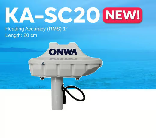
Satellite compass KA-SC20
The ONWA KA-SC20 satellite compass allows you to determine the location and course of your vessel in any weather conditions with maximum precision. The KA-SC20 satellite compass provides positioning accuracy of up to 2.5 m. The navigation device provides better data stability thanks to the speed and course pre-filtering technology. The accuracy of the course characteristics is guaranteed by the built-in gyroscope compensation system.
The satellite compass uses data from the Beidou and GPS satellite systems. It features fast startup, signal capture, course update up to 50 times per second, and a turn speed of up to 90°/s. The multi-channel standard output signal NMEA0183 of the KA-SC20 compass provides high stability and accuracy of course and vessel location data. The device is suitable for use in difficult marine conditions. It withstands temperatures from -30°C to +70°C and exposure to water.
The ONWA satellite compass uses decoding technology before commissioning to ensure more accurate orientation. The compass does not require additional maintenance due to the absence of mechanical parts in the design.
Applications of KA-SC20
- Navigation. An electronic compass helps ensure safe navigation by providing information about the vessel’s course, roll, trim, etc.
- Shipping. Increases the level of safety of ships, passengers, crew, cargo, displaying accurate information about the course, location of the vessel.
Reasons to buy
- Wide range of operating temperatures.
- Degree of protection IP56.
- Fast start, signal capture, course update up to 50 times per second.
- Built-in gyroscope compensation system.
- Receiving data from satellite systems Beidou, GPS.
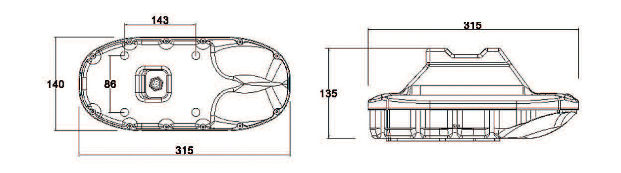
Dimensions
-
GENERAL
Baseline Length
20 cm
Heading Accuracy
1° RMS
Attitude Accuracy
Pitch/Roll: 0.4° RMS
Cold Start
<2 mins
Position Accuracy
2.5m
First Positioning Time
Cold Start: ≤32s
Hot Start: ≤32s
Recapture: ≤1sSpeed Measurement Accuracy
GPS + BDS: 0.1 m/s
Baseline Length
20 cm
Heading Accuracy
1° RMS
INTERFACE
Number of Ports
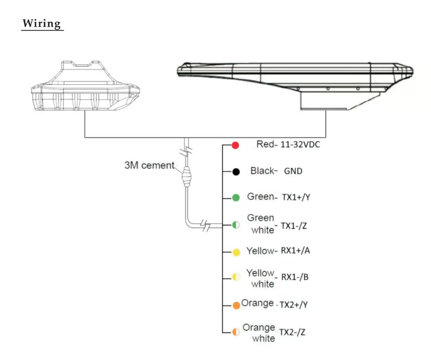
NMEA0183 Interface (RS422) x 2
1. Baudrate: 115200 (fixed)
2. Baudrate: default 4800 (adjustable)Data Sentences
RMC, VTG, GGA, GSA, GSV, GLL, ZDA, GST, HDT, HDG, THS, ROT
Power Supply
11~32V
Environmental Condition
Temperature
-30°C~ +70°C
Degree of Protection
IP56
Vibration
IEC60945
Compatible Devices
KP-38/39 5/7-inch Chartplotters
Choose Onwa's 5/7-inch Chartplotters for advanced features and confident GPS navigation.
ONWA KM-8/12 Series Marine Chartplotter
8 and 12- inch Multi-function chartplotters with Radar Display
KP-1299 Series Chartplotters
12-inch chartplotters with build-in radar function and optional AIS and Fishfinder functions.
ONWA KP-25/27 Series Marine Chartplotters
5 and 7- inch chartplotters with optional built-in Class B+AIS and fishfinder function
K-Astral Easy-to-use MFD Chartplotter
8″ and 12″ Full-featured MFD Chartplotter with Sensitive & Water-resistant Touchscreen and Traditional Keypad
You May Also Like
ONWA KA-GC9A Electronic Compass Heading Sensor
9-Axis Electronic Compass Heading Sensor with built-in High-accuracy GPS Module
Address: Room 706, Chai Wan Industrial City Phase 1, 60 Wing Tai Road, Chai Wan, Hong Kong
Tel: +852 2557 8166
E-mail Address:
info@onwamarine.com
sales@onwamarine.com


